
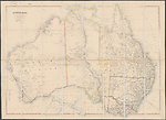
Map State Australia [West Sheet], W 1884/1
Stanford's London Atlas of Universal Geography
AUSTRALIA. Scale 1: 5 068 800.
London: Edward Stanford, 55 Charing Cross, March 20th 1884. Stanford's Geographical Establishment.
[WEST SHEET] Extent S11°--S38°30'/E112°--E137°30'
OVERLAP
The sheets are designed to be joined along E134°.
On the west sheet the area between E130°and E133° is not updated.
INSET:
[Eastern hemisphere]
Shows the principal telegraph lines and cables between Australia, Asia and Europe
Description
Shows
TITLE: AUSTRALIA
Appears top left hand corner within the neat lines
SCALE: 1:5 068 800
Appears beneath title
LEGEND:
A short legend showing roads, railways, telegraph lines, tracks of travellers and named heights appears beneath the scales.
PLATE NUMBERS:
Only shown in Contents List but not on plates. [68]
IMPRINT:
London: Edward Stanford, 55 Charing Cross, March 20th 1884. Stanford's Geographical Establishment.
INSET MAP:
Shows telephone lines and cables
COLONIES:
WESTERN AUSTRALIA, SOUTH AUSTRALIA
REGIONS:
DAMPIER LAND, KIMBERLEY, VICTORIA DISTRICT, EYRE LAND
COUNTIES: (NORTHERN TERRITORY)
PALMERSTON, DISRAELI, GLADSTONE
COUNTIES: (SOUTH AUSTRALIA)
JERVIS, MUSGRAVE, FLINDERS
COUNTIES: (WESTERN AUSTRALIA)
TABLE: List on left with 26 counties named
PASTORAL DISTRICTS: (WESTERN AUSTRALIA)
Northern District, Eastern District
NOTES ON COASTS:
Dampier Land, Dampier Archipelago
RIVERS:
Major rivers shown are from centre top of the map clockwise, the Victoria, Adelaide and its tributaries, Daly and its tributaries, the Alligator, Roper, Swan, the Murchison (has been extended to the north east), Ashburton, Fortescue, De Grey, Fitzroy and Ord.
LAKES:
Monger, Austin, Carey, Barlee, Lefroy, Cowan and Amadeus added.
EXPLORERS' ROUTES:
In the twenty two years since the plate was last updated many explorations of the central area of Western Australia have taken place and some in the north-west. The named tracks of the following appear: Alfred Delisser and Hardwick 1865, Robert John Sholl 1866 (Birman, W. 1976, p. 121-122), Francis Gregory 1868, John Forrest 1870, 1874, 1883, Henry Yorke Lyell Brown 1871, Ernest Giles 1872, 1873-4, 1875, 1876, Peter Egerton Warburton 1873, William Harry Tiekens and Jesse Young 1875 and Alexander Forrest 1879.
COMMUNICATIONS:
The Overland Telegraph from Port Augusta to Palmerston (1872) appears with its extension as the submarine cable from Palmerston to Java and Singapore.
The telegraph from South Australia to Albany and Perth and Northampton is shown.
Two private railway lines appear in the south west from Yoganup to Busselton and from Jarrah to Rockingham. The first government railway appears from Geraldton to Northampton (Victoria District).
REFERENCE:
Herbert, Francis (1989) pp. 106-109.
NOTES:
Northern Territory
The three counties of Palmerston, Disraeli and Gladstone appear. Further coastal definition of the north-east coastline shown by the delineation of Cadell Strait and Buckingham Bay, Elcho I., Hutchison and Goyder rivers named. There are many new names in the territory.
South Australia
The counties of Musgrave, Flinders and Jervis (Jervois?) appear in the Eyre Peninsula which is still shown as EYRE LAND. The features of Ayers Rock, Mt. Olga, Mt. Connor, Amadeus Lake and the Petermann Range are shown. There are many new names in South Australia. The services of Alfred and E. A. Delisser were accepted by the South Australian government in 1866 to examine the country between the western border of the state and the Head of the Great Australian Bight. They discovered the harbour of Eucla. (Threadgill, B. 1922, Part 1, p. 129-130)
Ernest Giles carried out three expeditions in the early seventies, two from east to west, the first in 1873 failing and again in 1875 from Beltana to Perth. On this latter expedition two of his party Tietkens and Young explored north to latitude 28°S. Giles returned to the east via a route along the Tropic of Capricorn from the Murchison to the Ashburton River, past the Rawlinson Range to Peake on the Overland Telegraph. (Threadgill, B.1922, Part 1, p. 155, Part 2, map 10.)
Western Australia
KIMBERLEY and VICTORIA DISTRICT appear.
Exploration extends inwards from the coast. John Forrest's first exploration in 1868-69 from Perth north-east to 28°S/123°E discovers geologically significant areas for mineral development,(Cannon, 1987, p. 237) Mt. Ida, and the present Mt. Leonora, Margaret and Malcolm. His next trip made in 1870 was from Esperance on the south coast following the coastline around the Great Australian Bight to Fowlers Bay and from thence to Adelaide.
Forrest's third exploration made in 1874 also appears on this state starting from Geraldton April 1st and proceeding up the Greenough River to the Murchison and north-east to the Robinson Range which he named and east across the centre at about latitude 25°-26°S reaching the Overland Telegraph towards the end of September after 6 months in the deserts of Western Australia.
East of the Murchison River and north of Lake Austin the Weld Mts. (Weld Range) 27°S/118°E appear discovered by the Government Geologist Henry Yorke Lyell Brown in 1871. Also shown in this state are the four journeys (1872-1876) of Ernest Giles, three being from the longitude of the Overland Telegraph heading towards the west, and one being from the west towards the east. A detour from the route confirmed the desertic nature of the Western Australian inland.
The first east-west crossing (1873) of Western Australia by Peter Egerton Warburton in the latitude S20° to S22° is shown but not that of William Gosse made at the same period.
Part of Alexander Forrest's 1879 expedition from Beagle Bay in the west Kimberley eastwards in search of grazing lands appears.
The Western Australian section of the telegraph line was completed 1877 (Cannon, (1987) p. 238) from Port Augusta in South Australia to Albany on the south-west coast largely follows John Forrest's route and then goes north to Perth and Northampton.
Two short private rail lines to service the timber industry appear in the south-west from Yoganup to Busselton and from Jarrah to Rockingham. The first government railway shown here was built in 1879 from Northampton to Geraldton.
CHANGES AND ADDITIONS
Following the death of John Arrowsmith in 1873 the plates of his London Atlas of Universal Geography were purchased by Edward Stanford. This map was first used by him in Stanford's London Atlas of Universal Geography, Preliminary Folio Edition. 1884. Printed only for private circulation.
The style of the map has been changed by the adoption of a different font and the removal of all the decorative coastal notes on discovery and the original Dutch names and dates of discovery for the various landfalls made by Dutch explorers. Colony names are now shown in solid black capitals. Over 120 new place names have been added and a minor number removed including many annotations of reference to soil and vegetation, explorers' camps with dates.
TITLE:
The most striking change is the removal of the beautiful Arrowsmith title and its replacement with the stark one word title 'AUSTRALIA'
SCALE:
Beneath the title are two linear scales.
LEGEND:
A short legend showing roads, railways, telegraph lines, tracks of travellers and named heights appears beneath the scales.
PLATE NUMBERS:
Not shown on these sheets but referred to in the Contents List of the privately circulated Preliminary Folio Edition of 1884 as [PL 68]
IMPRINT:
The imprint has been changed to indicate the new ownership but remains beneath the lower neat-lines, centre and right.
INSET:
The inset map updated to show telephone lines and cables to Asia and Europe from Australia and New Zealand.
COLONIES:
NORTH AUSTRALIA removed
REGIONS:
All regional names removed except DAMPIER LAND and EYRE LAND. KIMBERLEY and VICTORIA DISTRICT added.
NOTES ON COASTS:
Almost all descriptive notes have been removed.
INDIAN OCEAN appears off the North West Cape and below Albany. The GREAT AUSTRALIAN BIGHT is named.
Descriptive notes which do remain are two only for DAMPIER LAND and Dampier Archipelago.
RIVERS:
Major rivers shown are from centre top of the map clockwise, the Victoria, Adelaide and its tributaries, Daly and its tributaries, the Alligator, Roper, Swan, the Murchison (has been extended to the north east), Ashburton, Fortescue, De Grey, Fitzroy and Ord.
LAKES:
Monger, Austin, Carey, Barlee, Lefroy, Cowan and Amadeus added.
EXPLORERS' ROUTES:
In the twenty two years since the plate was last updated many explorations of the central area of Western Australia have taken place and some in the north-west. The named tracks of the following appear: Alfred Delisser, and Hardwick 1865, Robert John Sholl, 1866 (Birman, W. 1976, p. 121-122), Francis Gregory 1868, John Forrest, 1870, 1874, 1883, Henry Yorke Lyell Brown 1871, Ernest Giles 1872, 1873-4, 1875, 1876, Peter Egerton Warburton 1873, William Harry Tiekens and Jesse Young 1875 and Alexander Forrest 1879.
COMMUNICATIONS:
The Overland Telegraph from Port Augusta to Palmerston appears with its extension as the submarine cable from Palmerston to Java and Singapore.1872
The telegraph from South Australia to Albany and Perth is shown completed in 1877.
Two private railway lines appear in the south west from Yoganup to Busselton and from Jarrah to Rockingham. The first government railway appears from Geraldton to Northampton (Victoria District).
Key Dates
- 1839 - 1883
- Situation date
- May 1884
- Map Publication Date
Related entries
Timeline
West Sheet, W 1838/1
West Sheet, W 1839/1 (1838/2)
West Sheet, W 1840/1
West Sheet, W 1840/2
West Sheet, W 1840/3
West Sheet, W 1841/1
West Sheet, W 1842/1
West Sheet, W 1846/1
West Sheet, W 1847/1
West Sheet, W 1850/1 (1848/1)
West Sheet, W 1850/2 (1850/1)
West Sheet, W 1850/3 (1853/1)
West Sheet, W 1856/1
West Sheet, W 1858/1
West Sheet, W 1862/1
West Sheet, W 1862/2
Australia [West Sheet], W 1884/1
Australia [West Sheet], W 1887/1
Institutional and Other Holdings
National Library of Australia Map Collection
- Australia [cartographic material], 1884, MAP RM 875; National Library of Australia Map Collection. Details
Royal Geographical Society
- Australia, 1884, RGS mr [SLAUG. Fol. Ed. 1884]; Royal Geographical Society. Details
Published resources
Books
- Cannon, Michael, The exploration of Australia, Reader's Digest, Sydney, 1987, 304 pp. Details
- Threadgill, Bessie, South Australian land exploration, 1856 to 1880, Board of Governors of the Public Library, Museum and Art Gallery of South Australia, Adelaide, 1922. Details
Book Sections
- Birman, Wendy, 'Sholl, Robert John (1819-1886)', in Australian Dictionary of Biography, vol. 6, Melbourne University Press, Melbourne, 1976, pp. 121-122. http://adb.anu.edu.au/biography/sholl-robert-john-4576. Details
- Green, Louis, 'Giles, Ernest (1835-1897)', in Australian Dictionary of Biography, vol. 4, Melbourne University Press, Melbourne, 1972. http://adb.anu.edu.au/biography/giles-ernest-3611. Details
- Hartwig, Mervyn, 'Tietkens, William Harry (1844-1933)', in Australian Dictionary of Biography, vol. 6, Melbourne University Press, Melbourne, 1976, pp. 275-276. http://adb.anu.edu.au/biography/tietkens-william-harry-4722. Details
Journal Articles
- Herbert, Francis, 'The 'London Atlas of Universal Geography' from John Arrowsmith to Edward Stanford: Origin, Development and Dissolution of a British World Atlas from the 1830s to the 1930s', Imago Mundi, vol. 41, 1989, pp. 98-123. Details
Images
Dorothy F. Prescott
Created: 10 January 2012, Last modified: 28 August 2013