
Map Summary The South Eastern Portion of Australia
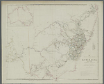
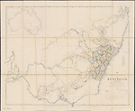
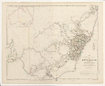
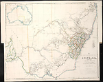
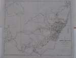
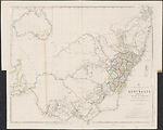
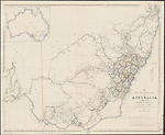
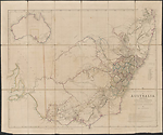
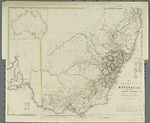
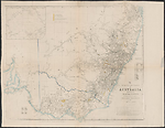
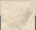
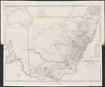
By 1839 John Arrowsmith had produced one of his replacement maps, The South Eastern portion of Australia, compiled from the Colonial Surveys and from details furnished by Exploratory Expeditions. This map covers almost the same area as Arrowsmith's Discoveries in Australia, that is, from the Brisbane region south to Spencer Gulf in South Australia, but at the larger scale of 1:2 660 000. Two degrees of longitude are lost at the left of the map with the result that the Eyre Peninsula of South Australia is not included in this map. The map takes the same plate number 35 in the London Atlas, indicating that it was meant to replace the 'Discoveries' map. An inset of the continent replaces that of the Colony of Western Australia in the 'Discoveries' map. There is no inset showing Australia's regional setting. It appears that Arrowsmith realised early in the life of the 'Discoveries' map that it would be insufficient for the detail he wished to incorporate. The abandoning of the earlier title supports this view.
This new map had a life of 20 years from 1838 until 1858 and in this time it went through twelve states. The principal changes are the defining of the major river systems of the south-east region of Australia, and the development of settlement through the southern part of New South Wales which in 1851 became the colony of Victoria. The coastal areas of New South Wales proper are explored and settled but the hinterland remains undeveloped. The changes in the south-east area of South Australia are minimal and confined to the coastal areas of the Fleurieu Peninsula. This map also appeared in two different states in the Parliamentary Papers of 1852 and 1853 where the map was updated to show the location of Gold Fields in New South Wales (Further papers, 1852 and 1853). It remained one of Arrowsmith's most important depictions of south-east Australia. The various states of this map have been grouped by date into separate chapters, i.e. 1838, the 1840s and the 1850s.
Related entries
Published resources
Books
- Further papers relative to the recent discovery of gold in Australia : in continuation of papers presented to Parliament, February 3, 1852. Presented to both Houses of Parliament by command of Her Majesty, June 14, 1852. [1508], Printed by George Edward Eyre and William Spottiswoode for HMSO, London, 1852. Details
- Further papers relative to the recent discovery of gold in Australia : in continuation of papers presented to Parliament, June 14, 1852. Presented to both Houses of Parliament by command of Her Majesty, Feb 28, 1853. [1607], Printed by George Edward Eyre and William Spottiswoode for HMSO, London, 1852. Details
Images
- Title
- The South Eastern Portion of Australia, 1838/1
- Type
- Map
- Repository
- National Library of Australia Map Collection
- Title
- The South Eastern Portion of Australia, 1838/2
- Type
- Map
- Repository
- National Library of Australia Map Collection
- Title
- The south eastern portion of Australia, 1838/3
- Type
- Map
- Repository
- The University of Melbourne Library, Eastern Resource Centre Map Collection
- Title
- The South Eastern Portion of Australia, 1838/4
- Type
- Map
- Repository
- National Library of Australia Map Collection
- Title
- The South Eastern Portion of Australia, 1841/1
- Type
- Map
- Repository
- National Library of Australia Map Collection
- Title
- The South Eastern Portion of Australia, 1842/1
- Type
- Map
- Repository
- National Library of Australia Map Collection
- Title
- The South Eastern Portion of Australia, 1844/1 (1842/2)
- Type
- Map
- Repository
- National Library of Australia Map Collection
- Title
- The South Eastern Portion of Australia, 1848/1
- Type
- Map
- Repository
- National Library of Australia Map Collection
- Title
- The South Eastern Portion of Australia, 1852/1
- Type
- Map
- Repository
- National Library of Australia Map Collection
- Title
- The South Eastern Portion of Australia, 1853/1
- Type
- Map
- Repository
- National Library of Australia Map Collection
- Title
- The South Eastern Portion of Australia, 1860/1 (1858/1)
- Type
- Map
- Repository
- National Library of Australia Map Collection
Dorothy F. Prescott
Created: 17 February 2011, Last modified: 9 June 2015